
 ● LIVE
Panoramic views: live panorama showing light, sky conditions and visibility across San Diego.
Nine live webcams across San Diego: the bay, Harbor Island, Shelter Island, the pier, railway activity and Lower Otay Reservoir.
8 webcams onlineSelect a live view: the Play button opens the dedicated page for that specific camera.
● LIVE
Panoramic views: live panorama showing light, sky conditions and visibility across San Diego.
 ● LIVE
Harbor Island: real-time view of the water, boats and maritime activity in San Diego.
 ● LIVE
Shelter Island Pier: real-time view of the water, boats and maritime activity in San Diego.
● LIVE
Harbor Island, south view: real-time view of the water, boats and maritime activity in San Diego.
 ● LIVE
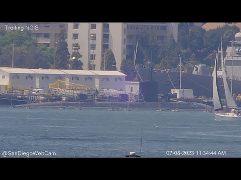
Bay, east view: live view of the water, landscape and weather conditions from San Diego.
 ● LIVE
Lake Otay: live view of the water, landscape and weather conditions from San Diego.
 ● LIVE
Shelter Island, north view: live panorama showing light, sky conditions and visibility across San Diego.
● LIVE
Shelter Island: live view of this location and its surroundings in San Diego.
The map connects the streams with the main viewed areas. Points indicate reference areas, not necessarily the exact camera position.
San Diego occupies the far southern end of California's Pacific coast, only a short distance from the Mexican border. The city has an unusually close relationship with San Diego Bay: port activity, marinas, naval facilities, waterfront districts and transport corridors all shape the urban landscape.
The nine Webcam OK streams focus strongly on the bay. Harbor Island and Shelter Island show boats, harbor traffic, skyline and marine conditions; the Rail Cam tells the city through tracks and transport; Lower Otay Reservoir extends the page into the South Bay landscape and the region's water system. Together they create a live guide built around city, water, mobility and landscape.
History, landscape and landmarks that help interpret what appears in the live images.
San Diego spreads along a complex coastline of ocean beaches, headlands and a large protected natural harbor. Its proximity to Tijuana gives the city a major cross-border dimension that influences employment, transport, commerce and culture.
The mild coastal climate and the presence of the ocean have encouraged a city closely connected with outdoor space. Waterfront parks, marinas and coastal districts are part of everyday life and explain why so many local webcams look toward water and horizon.
San Diego Bay is a long protected inlet supporting commercial port activity, recreational boating, shipyards, cruise terminals, ferries and major naval facilities. The Port of San Diego manages much of the public and maritime waterfront.
Bay webcams reveal constant movement: sailboats, yachts, service vessels, ships, aircraft approaches, reflections and changing visibility. Comparing several views helps reveal the true scale of the harbor.
Shelter Island lies on the northern side of San Diego Bay in the Point Loma area. It is an artificial peninsula developed during the twentieth century and now associated with marinas, hotels, dining, public spaces and boating.
The Port of San Diego maintains public boating facilities here, including guest docks and a boat launch. Pier, north-view and bay webcams are therefore useful for boat traffic, wind, water conditions and harbor light.
Harbor Island is another artificial peninsula on the north side of the bay. Its position between the airport and waterfront provides broad views across downtown San Diego, marinas and harbor activity.
Harbor Island cameras, including the south-facing view, offer a wider urban panorama than the more intimate Shelter Island views. They are especially effective around sunrise, sunset and evening when skyline light and reflections change quickly.
Point Loma forms the western side of the bay and helps create San Diego's protected natural harbor. The headland separates sheltered bay waters from the open Pacific and is essential to understanding Shelter Island and marine routes.
Even when Point Loma is not the central subject, its geography affects wind and sea conditions entering the bay. Webcams make the contrast between relatively calm harbor water and more exposed ocean conditions easier to understand.
Downtown San Diego rises immediately east of the bay. High-rises, hotels, terminals, event spaces and residential districts form a skyline that is particularly legible from the marinas and artificial peninsulas.
Panoramic views reveal the relationship between skyline and harbor through the day: morning light and service activity, heavier afternoon movement, and evening illumination reflected across the water.
Balboa Park is one of San Diego's major cultural landmarks. About 1,400 acres were set aside for a public park in 1868, and the site was later transformed by the 1915-16 Panama-California Exposition and the 1935-36 California Pacific International Exposition.
Although the webcams on this page do not point directly at the park, Balboa Park completes the picture beyond the waterfront. Museums, gardens and historic architecture demonstrate that San Diego is far more than a beach city.
The Rail Cam adds a completely different perspective. Passenger and freight rail corridors pass through the city, while the San Diego Trolley links downtown with many districts and the corridor toward San Ysidro.
The Trolley began service in 1981 and became one of the pioneering modern light-rail systems in the United States. The webcam makes trains, signals and network rhythm part of the live city story.
Lower Otay Reservoir lies in the southern part of the urban region, far from the central waterfront. The first dam was completed in 1897, and the reservoir was connected with the City of San Diego water system in 1906. After the dam failed during heavy rains in 1916, it was rebuilt in 1918.
Today the reservoir also supports regulated fishing and recreation. Its webcam shows a completely different landscape from San Diego Bay: inland water, hills, vegetation and changing water and light conditions.
San Diego International Airport sits immediately north of the bay and very close to downtown. Aircraft can therefore become part of some harbor panoramas alongside boats and road traffic.
This overlap of harbor, airport, roads and railway is one of San Diego's defining characteristics. Maritime, air and rail transport operate within a compact area, and the webcam network makes that relationship unusually visible.
Southern California's coast can shift from clear skies to marine haze or low cloud. These changes strongly affect skyline depth and visibility across the bay.
Shelter Island, Harbor Island and bay webcams therefore work as weather observation points as well as scenic views. Wind, water texture, low cloud and sunset light communicate real conditions better than a simple weather icon.
The nine streams work best as a system. Shelter Island shows recreational boating and harbor access; Harbor Island reveals skyline and bay scale; the Rail Cam follows land transport; Lower Otay opens a window onto the inland landscape.
During the day compare visibility and vessel traffic; at sunset the bay views transform; at night skyline, marina and harbor lights become the main subjects. Together the streams produce a much fuller San Diego than a single ocean view.
The different live views make it possible to compare districts, light, visibility and city movement at the same moment. The guide grows with the archive, keeping each webcam connected to the place it actually shows.