
 ● LIVE
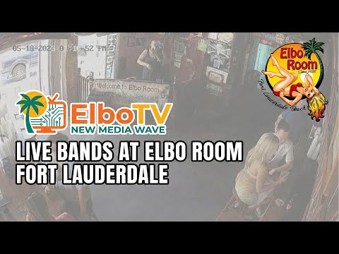
Elbo Room Bar: live view of this location and its surroundings in Fort Lauderdale.
Fort Lauderdale has several centres of gravity: the bends of the New River, the Atlantic beachfront and the waterways that connect homes, marinas and the sea. Moving between them reveals a city whose identity grew through trade, boating, tourism and cultural exchange, rather than around one monumental square.
6 webcams onlineSelect a live view: the Play button opens the dedicated page for that specific camera.
● LIVE
Elbo Room Bar: live view of this location and its surroundings in Fort Lauderdale.
 ● LIVE
Elbo Room Beach: live view of the shoreline, sea conditions and coastal atmosphere in Fort Lauderdale.
 ● LIVE
Port Everglades: live view of this location and its surroundings in Fort Lauderdale.
 ● LIVE
Elbo Room Patio: live view of this location and its surroundings in Fort Lauderdale.
 ● LIVE
Panorama from the Axis Experience Center: live panorama showing light, sky conditions and visibility across Fort Lauderdale.
 ● LIVE
Port Everglades, camera 3: live view of this location and its surroundings in Fort Lauderdale.
The map links the historic riverfront, Bonnet House and the Las Olas shore. Points identify places to visit, not camera installations.
Fort Lauderdale has several centres of gravity: the bends of the New River, the Atlantic beachfront and the waterways that connect homes, marinas and the sea. Moving between them reveals a city whose identity grew through trade, boating, tourism and cultural exchange, rather than around one monumental square.
The beach around Las Olas is its most immediately recognisable setting, but a rewarding visit also follows Riverwalk, enters historic houses and makes time for museums and shaded coastal habitats. Port Everglades adds another scale: ships link this urban coast to the Caribbean and wider international routes.
History, landscape and landmarks that help interpret what appears in the live images.
The Atlantic lies east of the beachfront barrier island; the Intracoastal Waterway runs behind it, while the New River winds through downtown. Residential canals and artificial waterfront plots complicate the street pattern. A destination that appears nearby across water may require a bridge and a longer journey. The nickname “Venice of America” describes this boating landscape, but Fort Lauderdale has its own subtropical ecology and modern urban history. River, canal and open sea offer quite different experiences.
The city’s name recalls an army fort built on the New River in 1838 during the Second Seminole War, associated with Major William Lauderdale. It is a reminder that the region’s history includes Indigenous communities and forced displacement, not simply the arrival of tourists. The later New River settlement developed through transport and commerce. Fort Lauderdale incorporated in 1911; subsequent property development, the harbour and expanding visitor economy progressively transformed a small settlement into a substantial South Florida city.
Frank Stranahan arrived in 1893 and operated a ferry and trading business. The wooden house built in 1901 developed from commercial and community premises into the home of Frank and Ivy Stranahan. Its verandas and riverside position explain an era when the water was a practical route for people and goods. Ivy’s teaching and civic work are central to the museum’s story. A guided visit adds human detail to the larger narrative of settlement and relations with Seminole people.
Riverwalk gives downtown a pedestrian thread along the New River, linking places for history, science and performance. History Fort Lauderdale’s museum campus preserves a different scale from the surrounding towers; the Museum of Discovery and Science offers interactive learning, while the Broward Center for the Performing Arts anchors the western cultural district. Boats passing through this urban corridor make the river an active part of the streetscape. Leave time to pause, rather than treating the walk as a transfer between ticketed attractions.
Las Olas Boulevard connects the downtown commercial and dining district with the island neighbourhoods and beachfront. Its restaurant-lined central section and its ocean end are different places, separated by waterways and residential areas. Near A1A, Las Olas Oceanside Park and the beach form an open-air meeting point. The white wave-shaped wall and promenade are distinctive coastal landmarks. Plan the city and beach sections separately: strolling among shops does not mean you are already beside the ocean.
Elbo Room, at Las Olas Boulevard and A1A, opened in 1938. Its association with the 1960 film “Where the Boys Are” connects this corner to the national image of Fort Lauderdale as a holiday and spring-break destination. The bar, its patio and the adjacent beach represent different aspects of that setting: entertainment inside, social life at the edge of the street and the Atlantic shore beyond. Their shared address does not make these experiences interchangeable.
Frederic Clay Bartlett created Bonnet House in 1920 on land given by Hugh Taylor Birch to Bartlett and Birch’s daughter Helen. The house and gardens combine artistic interests with the landscape of a barrier island. Courtyards, collections and vegetation offer a more intimate encounter than the large beachfront hotels. Visit for the relationship between domestic life, art and nature, rather than expecting a conventional palace. Check the available house and garden visit options before planning the day.
North of the main Las Olas beach area, Hugh Taylor Birch State Park occupies land between the Intracoastal Waterway and the ocean. Shaded maritime woodland, mangrove environments and a coastal dune lake preserve pieces of a landscape largely displaced by urban development. Interpretive walks help explain why a green patch on a city map can contain several habitats. Keep to designated trails, allow for heat and check current access arrangements for water activities; facilities can close independently of the wider park.
NSU Art Museum Fort Lauderdale adds an important visual-arts stop, including collections associated with William Glackens and the European Cobra movement. Beyond the riverfront, the historic Sistrunk corridor and the African-American Research Library and Cultural Center broaden the city’s story through Black history, literature and community life. Food likewise reflects South Florida’s connections: seafood, Caribbean and Latin American influences, and Southern traditions coexist. These cultural layers deserve time alongside beach leisure and the city’s well-known boating scene.
The harbour’s official dedication took place in 1928, after a channel connected the former Lake Mabel harbour area to the sea. Today Port Everglades combines cruise, cargo and energy-related activity. It spans parts of Fort Lauderdale, Hollywood, Dania Beach and unincorporated Broward County; its name does not place it inside Everglades National Park. Ocean-going vessels, pleasure boats and terminal infrastructure operate at different scales. The secured port is a working facility, with access procedures distinct from those of a public beach.
Begin with a riverside walk and a historic-house or museum visit, then spend a separate afternoon on Las Olas and the beachfront. A second day can combine Bonnet House with Birch State Park. Road transport and water-based services serve different routes; check current stops, fares and operating times before relying on a connection. Allow extra time for bridge openings, traffic and cruise embarkation. Fort Lauderdale-Hollywood International Airport serves the area, but an airport arrival, downtown stop and cruise terminal are separate destinations.
Winter is often appealing for outdoor sightseeing; summer brings heat, humidity and the possibility of afternoon thunderstorms. Seek shade and avoid planning every outdoor visit at midday. At the beach, follow lifeguard instructions and posted flags: a camera image cannot establish safe swimming conditions. The map highlights Stranahan House, Bonnet House and the Las Olas shore as orientation landmarks. It does not identify camera mounts. Combine the map with official visitor information for opening times, reservations and any temporary restrictions.
The different live views make it possible to compare districts, light, visibility and city movement at the same moment. The guide grows with the archive, keeping each webcam connected to the place it actually shows.