
 ● LIVE
Hogs Breath Saloon: live view of this location and its surroundings in Key West.
Key West sits at the road-connected western end of the Florida Keys, where a compact historic town meets a much larger marine landscape. Wooden houses, working waterfronts, literary landmarks and busy entertainment streets coexist on an island whose history has been shaped by movement across the water. Its links with the Bahamas and Cuba are essential to understanding the architecture, food and communities behind the holiday image.
5 webcams onlineSelect a live view: the Play button opens the dedicated page for that specific camera.
● LIVE
Hogs Breath Saloon: live view of this location and its surroundings in Key West.
 ● LIVE
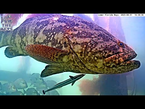
Underwater camera: live view of fish and the marine environment in the Lower Keys near Key West.
 ● LIVE
Southernmost Point: live view of this location and its surroundings in Key West.
 ● LIVE
Duval Street: real-time view of urban life and activity in Key West.
 ● LIVE
Bight Marina: real-time view of the water, boats and maritime activity in Key West.
Visitor reference points connect the northern waterfront, the historic town and Fort Taylor. They are not surveyed camera positions; the Lower Keys underwater location remains unspecified.
Key West sits at the road-connected western end of the Florida Keys, where a compact historic town meets a much larger marine landscape. Wooden houses, working waterfronts, literary landmarks and busy entertainment streets coexist on an island whose history has been shaped by movement across the water. Its links with the Bahamas and Cuba are essential to understanding the architecture, food and communities behind the holiday image.
The cameras grouped here cover different subjects: a named saloon, Duval Street, the Southernmost Point area, Key West Bight Marina and an underwater location identified only as the Lower Keys. That last entry should not be read as a precisely located reef off Key West. Together they invite a journey between streets, harbour activity and underwater habitats, while keeping each setting geographically distinct.
History, landscape and landmarks that help interpret what appears in the live images.
U.S. Highway 1 reaches its southern terminus in Key West, but the Keys continue farther west beyond the road. Dry Tortugas National Park requires a separate boat or seaplane journey; it is not a short extension of an Old Town walk. Likewise, the Lower Keys name covers a region, not one beach or reef. Distances on a map can be deceptive when a journey crosses bridges, channels or open water.
Old Town is best understood through short connected walks. Duval Street provides a busy spine, while Whitehead Street, Bahama Village and the historic waterfront reveal different rhythms nearby. The port, southern shore and marina are separate places. Reading their relationship first makes it easier to choose a manageable route and avoid treating every coastal attraction as the same waterfront.
Key West’s position beside shipping routes supported salvage, fishing, sponging and other maritime trades. The Historic Seaport preserves the setting of an economy that depended on boats, storage, processing and skilled labour. Historic turtle harvesting is part of that story; it belongs to an earlier commercial world and should not be mistaken for a present-day visitor activity.
Bahamian and Cuban connections helped shape the island’s communities and built environment. Wooden houses, shaded porches and streets of relatively modest scale provide a different urban experience from mainland Florida’s high-rise coast. Bahama Village deserves time beyond a passing photograph: it introduces a Caribbean heritage that is not explained by the bars of Duval Street alone. Museums supply context that picturesque façades cannot provide by themselves.
The historic district rewards attention at the scale of a porch, fence or shaded side street. Timber construction and verandas give the town a recognisable texture, but the houses are not an interchangeable row of holiday backdrops. Buildings have different ages, uses and histories; some remain homes, while others accommodate visitors or businesses. A walk becomes more interesting when it distinguishes the public street from a domestic garden and a historic appearance from a building open for interpretation.
The island’s architecture developed through Caribbean connections, climate and practical building traditions. Bahamian influences belong within that wider history of movement, rather than being treated as an exotic detail added to an otherwise isolated American town. Shorter blocks off the busiest routes can reveal changes in scale and activity. Explore quietly, avoid blocking residential entrances and allow time to notice how shade, plants and porches mediate between interior rooms and the street.
Duval connects the island’s northern visitor district with its southern shore. Restaurants, galleries, shops and entertainment venues change in character from block to block. A named camera on this street does not establish which intersection, façade or stage is visible. The more useful starting point is the street’s role as a social and commercial corridor within a residential town.
Key West’s LGBTQ cultural life is an important part of its modern identity. Around the 700 and 800 blocks, the district often called the Pink Triangle brings together venues and businesses associated with that history. Entertainment programmes and access vary. A daytime architectural walk, a museum visit and an evening show offer different ways into the city; choosing deliberately is more rewarding than assuming all nightlife venues provide the same experience.
The Ernest Hemingway Home & Museum on Whitehead Street connects the island with the writer’s 1930s life and work. His writing studio adds a specific place to a literary reputation often reduced to a bar anecdote. The Harry S. Truman Little White House offers another perspective: a presidential retreat and working residence, with its own guided interpretation. Neither attraction is automatically visible from the listed street cameras.
Near the northern waterfront, the red-brick Custom House dates from 1891 and is associated with the Key West Art & Historical Society. These institutions help place the holiday town within wider national and Caribbean histories. Farther from the main bar district, the African Cemetery at Higgs Beach commemorates people rescued from slave ships in 1860. It is a place for reflection, adding a necessary human dimension to a maritime story.
The African Cemetery at Higgs Beach commemorates people who died after being brought to Key West in 1860 from intercepted slave ships. Interpreting that site gives the Atlantic shore a meaning quite different from recreation. The memorial is part of a history of forced movement and humanitarian crisis, which should be approached on its own terms rather than folded into a picturesque account of seafaring adventure. It requires a separate journey from the northern waterfront.
Nearby, the Key West AIDS Memorial offers another place of remembrance. These public memorials widen a visit dominated by famous writers, presidents and entertainers. They remind visitors that the town’s identity rests on communities and individual lives, including loss and mutual support. A museum programme or a self-guided historical resource can help connect these places without turning them into a rushed sequence of photo stops. The listed cameras do not document the memorials themselves.
The Hemingway property makes the distinction between home and workplace tangible. The Whitehead Street house was purchased for Ernest and Pauline Hemingway in 1931, and the writing studio belongs to a daily routine as well as a literary reputation. The grounds, architecture and pool add a domestic setting to the author’s years on the island. The museum’s resident cats are a familiar association, but the most revealing visit also gives time to the rooms and interpretation rather than concentrating solely on that detail.
The Little White House began in 1890 as naval officers’ quarters, well before Truman’s first presidential visit in 1946. That sequence matters: the building was adapted into a retreat within an existing naval landscape. The Custom House offers a third form of public history. Opened in 1891, it brought customs, postal and federal judicial functions into a substantial red-brick building. Its restoration and museum use demonstrate how preservation can provide a new civic role. Together, the three sites connect private life, federal administration and the island’s maritime position without telling the same story three times.
Key West Bight and the Historic Seaport combine berths, waterfront walking, food and excursion departures. A marina is a functioning space: public paths, private docks and boarding areas serve different purposes. Allow time to look at the relationship between boats and shore rather than treating the harbour only as the starting point for an excursion. Mallory Square, on another part of the northern waterfront, is known for its sunset gathering.
The Southernmost Point buoy is the familiar painted concrete landmark traditionally located at South and Whitehead streets. It is a civic symbol, not proof of an absolute geographic superlative across every U.S. territory or nearby island. Official information reports construction around the original site and a temporary marker at the southern end of Duval Street. Consult the city’s current arrangements before planning access; a catalogued camera name does not confirm that works are finished.
Cuban coffee, seafood and Caribbean influences offer a practical way to encounter the island’s connections. A meal near the seaport can sit beside a walk through former maritime working areas, while businesses in Bahama Village provide a different neighbourhood context. These are living commercial and community settings, not reconstructed exhibits. Look at current menus and opening arrangements rather than assuming every place with an old sign maintains the same cooking or service across decades.
Key lime pie is an established island association, but claims about a single inventor are more contested than a menu might suggest. Enjoying a local speciality need not depend on repeating an unverified origin story. The same applies to writer-associated bars: an entertaining connection is not a substitute for literary history. Choosing one meal and leaving time to explore its surroundings often adds more to a visit than moving repeatedly between celebrated names.
Fort Zachary Taylor Historic State Park combines coastal recreation with a fort built to defend the harbour. Its Union occupation during the Civil War adds a military chapter to the island’s history. The fort and beach deserve a separate visit with attention to park access and facilities. They should not be presented as features of an unidentified underwater camera.
The Lower Keys marine environment includes coral communities, hardbottom, seagrass meadows, mangroves and sandy areas. These habitats are linked through water movement, shelter and food webs. Seagrasses are flowering plants rather than seaweed, and mangrove roots provide habitat as well as coastal structure. An underwater view can introduce this diversity without guaranteeing coral, a named species or a clear-water scene at any particular moment.
A first day can pair the Historic Seaport and northern Old Town, then reserve another period for Whitehead Street’s museums and the southern shore. Add the state park or a properly arranged boat excursion according to interests and weather. The map marks visitor landmarks, not camera mounts; no exact point is assigned to the Lower Keys underwater entry.
Heat, humidity, sudden storms and exposed waterfront walking affect a day outdoors. Carry water, plan shade and check official weather and operator information before marine outings. Confirm museum hours, current transport services and the exact accessibility of entrances and paths. A webcam provides atmosphere within a limited field of view; it cannot establish a boat’s departure, a safe swimming condition or the current accessibility of an entire district.
Arrival planning matters even on a compact island. The long Overseas Highway journey is a regional trip with its own stops and traffic, while arriving by air or ferry leaves a different final connection to accommodation. Confirm the current Duval Loop route or other transport directly with the city before relying on it. A historic district described as walkable can still present uneven surfaces, heat, crowded pavements and entrances with different access requirements. Check the precise facilities needed with a venue rather than assuming an entire neighbourhood offers the same conditions.
The different live views make it possible to compare districts, light, visibility and city movement at the same moment. The guide grows with the archive, keeping each webcam connected to the place it actually shows.