
 ● LIVE
Sunset Grille: live view of this location and its surroundings in Marathon.
Explore Marathon from the Seven Mile Bridge area to Sombrero Beach and Grassy Key, with maritime history, island habitats and waterfront life as the connecting threads.
4 webcams onlineSelect a live view: the Play button opens the dedicated page for that specific camera.
● LIVE
Sunset Grille: live view of this location and its surroundings in Marathon.
 ● LIVE
Sparky’s Landing: live view of this location and its surroundings in Marathon.
 ● LIVE
Sombrero Beach: live view of the shoreline, sea conditions and coastal atmosphere in Marathon.
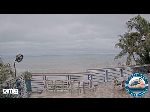 ● LIVE
Grassy Key, Florida: live view of the island landscape and tropical surroundings near Marathon.
The points locate Sombrero Beach and Curry Hammock State Park as tourist references. They do not mark camera installations; Grassy Key and the bridge area are separate parts of the wider island itinerary.
Marathon occupies a chain of islands in the Middle Florida Keys rather than one compact town centre. The four webcams in this collection introduce distinct parts of that landscape: Sunset Grille near the Seven Mile Bridge, the waterfront associated with Sparky’s Landing, Sombrero Beach and Grassy Key. Together they suggest a destination understood through water, road connections and small island environments.
Grassy Key remains under Marathon in the catalog because it is one of the islands within the municipality. Its own name and quieter geographical identity are important, and are retained throughout this guide. The different subjects are not interchangeable views from one beach resort.
History, landscape and landmarks that help interpret what appears in the live images.
Marathon incorporated in November 1999. The city describes its extent from the eastern end of Seven Mile Bridge near mile marker 47 to the western end of Toms Harbor Bridge near mile marker 60. Vaca Key, Knights Key, Boot Key, Fat Deer Key, Little Crawl Key and Grassy Key are among its islands. This geography explains why distances and specific addresses matter more than the assumption of a single walkable downtown.
The Overseas Highway is the principal thread connecting the islands. Mile markers are useful local references: lower numbers lead toward Key West, higher numbers toward Key Largo and the mainland. They are approximate orientation tools rather than substitutes for an entrance address. A regional visitor description may cover nearby islands beyond municipal boundaries, so distinguish the city from the wider Marathon destination when choosing accommodation or transport.
The Keys divide open Atlantic-facing waters from the shallower bay and Gulf-side environments. Channels connect these waters, while mangroves, flats and sheltered inlets produce a coast very different from a continuous mainland surf beach. Water may be close on several sides without every property sharing the same exposure, swimming conditions or boating access. The familiar terms oceanside and bayside help organise an itinerary, but they do not establish the direction of an unverified camera.
Boot Key Harbor illustrates Marathon’s boating identity. Protected moorings and waterfront services support visiting vessels and a working maritime community. The harbour experience is distinct from a public sandy beach or an offshore reef excursion. The city’s anchorage information also identifies Bone Fish Bay on the Atlantic side between Grassy Key and Key Colony Beach. Understanding named water spaces gives more meaning to marina addresses and helps avoid treating every inlet as the same harbour.
Marathon’s history precedes the modern road trip. Early island communities included Bahamian settlers, farming and fishing livelihoods, while maritime work connected people across water long before cars crossed the bridges. Crane Point preserves an important introduction to those earlier layers. A modern waterfront restaurant belongs to a different period, but the continuing dependence on marine access provides a connection between old and new island life.
The railroad brought a dramatic transformation. Henry Flagler’s Key West extension, completed in 1912, connected the island chain with the mainland by rail. Bridges turned narrow pieces of land into parts of a single transport route. The city’s account links the name Marathon to the strenuous pace of railway construction. This should be understood as a local naming tradition, while the surviving bridge structures and Pigeon Key provide tangible evidence of the engineering enterprise.
The modern Seven Mile Bridge and its older neighbour are separate structures. The older line began as railway infrastructure, was later adapted for road traffic and now has a restored pedestrian and cycling section from Marathon toward Pigeon Key. The present road bridge opened in 1982. Their parallel presence makes the western end of Marathon an unusually clear place to see successive transport eras in one landscape.
Pigeon Key served as a construction-camp island during the railroad project. Workers lived there beside the developing bridge; preserved buildings and museum interpretation bring the human scale back into a vast engineering story. The restored old-bridge section reopened for recreation in 2022. A bridge walk and admission to the island are different arrangements, so confirm current access, transport and tour details rather than assuming that walking toward Pigeon Key includes every service or museum visit.
Sunset Grille identifies its setting as Knights Key near mile marker 47 at the foot of the Seven Mile Bridge. It represents the leisure side of this prominent crossing: food, outdoor social space and the changing light over water. The restaurant’s location gives the webcam a specific geographical context without proving the exact installation or every feature in its field of view. The bridge is a nearby landmark, not an automatically verified frame element.
Sparky’s Landing provides another restaurant-based subject, linked more closely to the harbour and boating atmosphere of the eastern Marathon area. Its current official address is 13205 Overseas Highway, on the water behind the Fairfield Inn & Suites. The business also uses a Key Colony Beach mailing address, which should not be mistaken for its current visitor entrance. Dining beside the water, arriving by boat and planning a beach afternoon are different activities with separate practical requirements.
Sombrero Beach is a public sandy beach and park reached by following Sombrero Beach Road toward the Atlantic. Shade, picnic pavilions, play facilities, showers and restrooms make it more than a strip of sand. The city redeveloped the park for accessibility in 2001. This municipal setting distinguishes it from a private resort beach and from the rocky or mangrove-fringed shores found elsewhere in the Keys.
The beach is also sea-turtle nesting habitat. The city describes nesting activity particularly from April through October and restricts use around active nests. Respect marked areas and leave turtles undisturbed; an evening on a nesting shore requires different behaviour from an illuminated entertainment district. Sombrero Beach is not Sombrero Reef. The reef is an offshore marine destination reached through a separate boating plan, and its name does not make it a walk-out feature of the park.
Crane Point combines nature trails, museum interpretation and historic buildings within Marathon’s developed island landscape. Its hardwood hammock gives a sense of vegetation that can be hidden behind the highway’s commercial frontage. Here hammock means a wooded habitat, not an outdoor swing. Walking beneath a canopy changes the scale of the visit from distant water horizons to tree forms, shade and small details along a path.
The Adderley House connects the site with Bahamian settlement and the community once established here. The later Crane House represents another chapter of the property’s history. Museum displays, the trails and the wild bird rehabilitation work introduce different ways of understanding an island, from human occupation to habitat care. Allow time for these subjects rather than treating the site as a quick photograph stop on the way to the bridge.
Curry Hammock State Park protects a large undeveloped area between Key Largo and Big Pine Key. Mangrove swamps, rockland hammock and seagrass beds belong to one connected coastal system. Mangrove roots shelter marine life; seagrass flats support animals in shallow water; the hammock offers an inland wooded environment. The park is valuable because these habitats can be understood together, rather than as isolated patches beside a road.
The park’s Atlantic beach, nature trail and paddling opportunities offer different ways to explore. Official information describes routes involving a mangrove tunnel, lagoon, grassy flats, sandbars and open water. Choose the actual route according to ability and conditions. A kayak launch does not turn every surrounding channel into a suitable beginner outing, and the state park cautions that coral rock can produce uneven footing in the shore environment. Confirm rentals and current arrangements before relying on them.
Grassy Key lies toward the upper, northeastern end of Marathon’s island chain. The highway joins its visitor businesses and residential areas with the rest of the city, while the island’s own name remains the clearest local reference. A camera catalogued simply as Grassy Key has an island-scale identity; there is no basis for assigning it to a particular resort, beach or compass direction without further documentation.
Dolphin Research Center is a prominent Grassy Key institution focused on marine-mammal research, education and care. It is a managed facility with resident animals and visitor programmes, distinct from an encounter with wildlife in open water. Elsewhere, the city identifies Sunset Bay Park at Morton Street and Kyle Avenue as a Gulfside natural retreat. These are independent places to visit and contextual references, not features claimed visible in the Grassy Key camera.
Marathon offers several different kinds of marine education. The Turtle Hospital rehabilitates injured sea turtles and introduces visitors to its work through educational visits. Aquarium experiences and research-centre programmes follow their own formats. They should not be combined into a generic promise of swimming with wildlife: some activities are primarily observation, others involve organised contact under a facility’s rules, and a rehabilitation hospital has an animal-care purpose.
Offshore, Sombrero Reef and the Thunderbolt wreck are recognised diving and snorkelling references in the wider Marathon area. They require an appropriate operator, suitable conditions and a separate assessment of the activity. A beach camera cannot describe underwater visibility at a reef miles away. Conversely, time in a museum or on a hammock trail can add depth to a marine holiday without needing a boat trip every day. The strongest itinerary mixes viewpoints rather than repeating the same encounter.
Charter fishing, marinas and waterfront restaurants reflect a place where visitor recreation overlaps with maritime livelihoods. A meal beside a dock can introduce this culture, but not every fish on a menu was landed at the adjacent slip and not every vessel has the same purpose. Ask about the food and the activity that interests you instead of reading all waterfront details as a staged tourist scene. Working berths and service areas also require space for their normal operations.
The Overseas Highway corridor supplies ordinary community services alongside holiday accommodation. This is another reason to see Marathon as a lived city spread across islands. A restaurant-focused webcam, a public beach and a less precisely identified Grassy Key view reveal different pieces of that life. Comparing them is useful when their differences are retained: social waterfront, municipal recreation, transport history and island habitat each add something to the destination.
One outing can concentrate on the western bridge area and, if arranged, Pigeon Key. Reserve another for Sombrero Beach and Crane Point, allowing time to change between open shore and woodland. A Grassy Key and Curry Hammock day follows a different section of the highway. The purpose of separating these outings is to enjoy the specific environments rather than rush back and forth across the same road corridor.
Distances, bridge traffic and the timing of a booked boat or museum visit matter more than a nominal number of stops. Bring water, allow for heat and check official weather guidance when thunderstorms or tropical weather threaten. Confirm access needs directly with the relevant park or operator. The map marks tourist places with documented geographical references; it does not turn restaurant addresses or beach names into verified camera mounting coordinates.
The different live views make it possible to compare districts, light, visibility and city movement at the same moment. The guide grows with the archive, keeping each webcam connected to the place it actually shows.