● LIVE
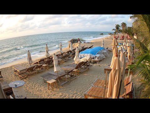
Live view from Ko Samui.
Twelve live webcams across Ko Samui: Chaweng, Soi Green Mango, Bo Phut and Fisherman’s Village, Bangrak, Lamai, beaches, nightlife and food markets.
7 webcams onlineSelect a live view: the Play button opens the dedicated page for that specific camera.
The map connects the streams with the island areas they represent. Points indicate viewed areas and not necessarily the exact camera position.
Ko Samui is one of the best-known islands in the Gulf of Thailand and belongs to Surat Thani Province. It is Thailand's third-largest island and part of an archipelago of more than eighty islands that also includes Mu Ko Ang Thong National Marine Park. Although Samui is famous for beaches, the island is far more varied: villages, commercial roads, markets, temples, bays, coconut landscapes and nightlife districts create very different environments.
The twelve Webcam OK streams are concentrated mainly on the eastern and north-eastern coasts. Chaweng shows the island's most dynamic urban and nightlife side; Bo Phut combines beach with the memory of an old fishing community; Bangrak opens toward the sea and the Big Buddha area; Lamai has a more relaxed beach-town character; Banyan Food Market adds a contemporary food and social scene.
History, landscape and landmarks that help interpret what appears in the live images.
Ko Samui lies off the coast of Surat Thani in the Gulf of Thailand. Ferries and flights connect the island with the mainland and other destinations, while a ring road links the main coastal communities. Despite international tourism, different beaches and districts still retain very distinct characters.
Chaweng and Lamai dominate the east coast; Bo Phut, Bangrak and Big Buddha are in the north-east; Nathon on the west has long been associated with mainland connections. This geography explains why nearby webcams can show different wind, sea and crowd conditions.
For much of its history Samui depended on fishing, coconut cultivation and regional sea links. Coastal communities grew around small harbours and villages, while the interior retained an agricultural landscape.
Tourism transformed the island, particularly around Chaweng, Lamai and Bo Phut. Hotels, restaurants, markets, nightlife and services grew alongside older activities. Live webcams reveal the overlap between tropical landscape and contemporary resort life.
Chaweng is one of Samui's best-known beach areas and concentrates a large share of hotels, restaurants, shopping and nightlife. Its long white beach is backed by a much denser urban strip than in many other parts of the island.
The Chaweng webcams focus strongly on street life: Soi Green Mango, bars, roads and evening activity. They become especially revealing when compared between afternoon, evening and late night as lighting, traffic and pedestrian movement change.
Soi Green Mango is one of the names most closely associated with Chaweng nightlife. Bars and entertainment venues turn the lane into a very different environment after dark.
A live camera here shows a daily cycle rather than a static street. Daytime is about deliveries, preparation and ordinary traffic; evening brings stronger lighting, pedestrian flows and entertainment activity.
Bo Phut preserves one of Samui's most distinctive built environments. Fisherman’s Village developed from an old fishing community and today mixes older shophouses with restaurants, boutiques, a beachfront promenade and visitor services.
The Bo Phut webcam is valuable because it connects street and beach. Daytime is relatively relaxed; toward evening the promenade, dining and shopping become more active. Low-rise buildings and the seafront create a very different atmosphere from Chaweng.
Bangrak lies on the north-east coast between Bo Phut and the Big Buddha peninsula. The bay is associated with local marine transport as well as beaches, piers and services for boats.
The beach webcam is useful for sea state, visibility, boat movement and conditions across the bay. North-eastern Samui also gives a sense of the island's relationship with Ko Phangan and Gulf routes.
Lamai is one of the main east-coast resorts and is often perceived as more relaxed than Chaweng while still offering restaurants, shops, markets and nightlife. The beach fronts a compact urban centre.
Further south are the famous Hin Ta and Hin Yai rock formations. Along the coast, resorts, small restaurants and quieter sections alternate. Cameras at Bondi Lamai, Baobab and Banyan Tree reveal different sides of this part of the island.
One of the most practical uses of Samui webcams is checking actual beach conditions. Sea colour, waves, wind, cloud, rain, visibility and crowd levels can change quickly even within the same day.
Differences between Chaweng, Bo Phut, Bangrak and Lamai can be obvious. A sheltered bay may remain calm while another coast is exposed to stronger wind. Comparing several streams gives a better picture than a single weather image.
Coconut cultivation is part of Samui's economic history and tropical landscape. Local food combines seafood, fruit, southern Thai cooking and an international restaurant scene that expanded with tourism.
Banyan Food Market represents this contemporary side: several food businesses gathered around a large banyan tree with events and social spaces. Its webcam adds a different dimension to the island story beyond beaches.
Ko Samui is not only a beach destination. Temples and religious sites reflect Buddhist culture and the history of local communities. The Big Buddha area in the north-east is one of the island's best-known reference points.
Even when temples are outside the webcam frame, they matter to the surrounding landscape. Bangrak, Bo Phut and Chaweng are not simply tourist zones but parts of an island community with active markets, traditions and religious places.
West of Samui lies Mu Ko Ang Thong National Marine Park, a protected archipelago of limestone islands, bays and Gulf waters. It is one of the best-known excursion areas reached from Samui.
The webcams do not show the park directly, but they help reveal marine conditions affecting boat activity. Wind, cloud and sea state visible from Samui's beaches can change quickly.
The twelve streams work best together. Chaweng shows the urban and nightlife side; Bo Phut combines fishing-village memory with tourism; Bangrak shows sea and transport; Lamai a more relaxed east-coast environment; Banyan Food Market the island's contemporary food and social scene.
During the day, watch sea conditions, cloud, shadows and beach use; toward sunset the light changes; at night restaurants, markets, signs and pedestrians take over. Samui becomes a living island rather than a tropical postcard.
The different live views make it possible to compare districts, light, visibility and city movement at the same moment. The guide grows with the archive, keeping each webcam connected to the place it actually shows.