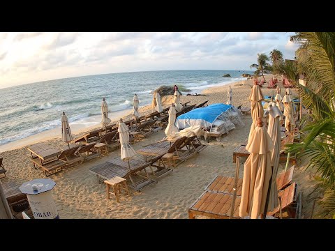
Ko Samui - Panorama dell’isola live
This webcam provides a more general view of Ko Samui and works as a comparison point for the more specific streams. Sea, cloud, light and coastal conditions reveal the island's tropical character in real time.
An island in the Gulf of Thailand
Ko Samui lies off the coast of Surat Thani in the Gulf of Thailand. Ferries and flights connect the island with the mainland and other destinations, while a ring road links the main coastal communities. Despite international tourism, different beaches and districts still retain very distinct characters.
Chaweng and Lamai dominate the east coast; Bo Phut, Bangrak and Big Buddha are in the north-east; Nathon on the west has long been associated with mainland connections. This geography explains why nearby webcams can show different wind, sea and crowd conditions.
Beaches, sea and real-time conditions
One of the most practical uses of Samui webcams is checking actual beach conditions. Sea colour, waves, wind, cloud, rain, visibility and crowd levels can change quickly even within the same day.
Differences between Chaweng, Bo Phut, Bangrak and Lamai can be obvious. A sheltered bay may remain calm while another coast is exposed to stronger wind. Comparing several streams gives a better picture than a single weather image.
From fishing communities to an international destination
For much of its history Samui depended on fishing, coconut cultivation and regional sea links. Coastal communities grew around small harbours and villages, while the interior retained an agricultural landscape.
Tourism transformed the island, particularly around Chaweng, Lamai and Bo Phut. Hotels, restaurants, markets, nightlife and services grew alongside older activities. Live webcams reveal the overlap between tropical landscape and contemporary resort life.
Mu Ko Ang Thong and the wider seascape
West of Samui lies Mu Ko Ang Thong National Marine Park, a protected archipelago of limestone islands, bays and Gulf waters. It is one of the best-known excursion areas reached from Samui.
The webcams do not show the park directly, but they help reveal marine conditions affecting boat activity. Wind, cloud and sea state visible from Samui's beaches can change quickly.
Temples and island culture
Ko Samui is not only a beach destination. Temples and religious sites reflect Buddhist culture and the history of local communities. The Big Buddha area in the north-east is one of the island's best-known reference points.
Even when temples are outside the webcam frame, they matter to the surrounding landscape. Bangrak, Bo Phut and Chaweng are not simply tourist zones but parts of an island community with active markets, traditions and religious places.
How to read Ko Samui through its webcams
The twelve streams work best together. Chaweng shows the urban and nightlife side; Bo Phut combines fishing-village memory with tourism; Bangrak shows sea and transport; Lamai a more relaxed east-coast environment; Banyan Food Market the island's contemporary food and social scene.
During the day, watch sea conditions, cloud, shadows and beach use; toward sunset the light changes; at night restaurants, markets, signs and pedestrians take over. Samui becomes a living island rather than a tropical postcard.
What this live view reveals
This webcam provides a more general view of Ko Samui and works as a comparison point for the more specific streams. Sea, cloud, light and coastal conditions reveal the island's tropical character in real time.
What to watch live
Watch sea or traffic depending on the view, plus light, wind, cloud, crowd levels and changes between day and evening.