● LIVE
Live view from Amsterdam.
Nine webcams to read Amsterdam in real time: canals, Dam Square, Damrak, Centraal Station, Stationseiland, Dijksgracht and the Vijf Bruggen railway works.
9 webcams onlineSelect a live view: the Play button opens the dedicated page for that specific camera.
The map connects the live views with places that help explain the historic centre, station, water and infrastructure.
Amsterdam is a city built around water. Its medieval core grew near the Amstel, while from the late sixteenth century into the seventeenth the city expanded through a planned system of concentric canals that turned wet ground into organised urban districts. Narrow houses, bridges, quays, bicycles, trams, trains and boats now coexist within a remarkably compact landscape.
The nine live views on this page show a less static Amsterdam than the postcard image. Some look at the monumental core between Centraal Station, Damrak and Dam Square; others follow the railway side of the city through Dijksgracht, Stationseiland and the Vijf Bruggen project; the eastern waterfront panorama helps connect the historic centre with the IJ and the modern docklands.
History, landscape and landmarks that help interpret what appears in the live images.
The name Amsterdam points directly to the city's origin: a settlement growing around a dam on the Amstel. The medieval core developed between the river and the IJ, with port activity, trade and transport by water. Damrak and Rokin still follow the old Amstel axis and meet around Dam Square.
From the late sixteenth century through the seventeenth, the city planned a major expansion west and south of the old centre. Herengracht, Keizersgracht and Prinsengracht were laid out in concentric arcs, while radial waterways and streets connected the new districts with the port and existing town. This was a major hydraulic and urban-planning project rather than spontaneous growth.
In 2010 UNESCO inscribed the seventeenth-century canal ring inside the Singelgracht on the World Heritage List. Its importance goes beyond picturesque façades: the district is an exceptional example of hydraulic engineering, town planning and the large-scale creation of an artificial port city.
The canal structure remains remarkably coherent. Gabled houses, bridges, trees, quays and narrow plots create a distinctive sequence of views. The webcams do not always look directly into the Grachtengordel, but they help explain a city in which water, streets and mobility are inseparable.
Dam Square is Amsterdam's civic and symbolic centre. Damrak and Rokin converge here, beside the Royal Palace, De Nieuwe Kerk and the National Monument. Everyday movement, tourism, ceremonies and public events overlap in this space more clearly than almost anywhere else in the city.
De Nieuwe Kerk has more than six centuries of history and still has a national role connected with royal ceremonies, official gatherings and cultural events. The PTZ webcam is therefore valuable because it does not show only a monument; it follows a living urban space whose character changes through the day.
Damrak connects Amsterdam Centraal with Dam Square and follows the former water route of the Amstel. In the medieval period this area was closely connected with port activity and trade; by the seventeenth century Amsterdam had become one of the major centres of global commerce.
Today Damrak is one of the principal pedestrian gateways into the centre. Trams, bicycles, visitors, shops and architecture such as the Beurs van Berlage keep it in constant motion. A live camera is especially useful here because movement is the defining quality of the place.
Centraal Station dramatically changed Amsterdam's relationship with the IJ. Three artificial islands were created for the station and thousands of piles were driven into the ground. The building, designed by P.J.H. Cuypers with A.L. van Gendt, opened in 1889 and was conceived as a monumental gateway for rail passengers.
Its location was controversial because Stationseiland partly cut the old centre off from the IJ waterfront. Today the station is both a historic monument and a contemporary transport machine in which trains, metro, trams, buses, ferries, bicycles and pedestrians meet.
Stationseiland is more than the physical base of the station. It is one of the clearest places for understanding Dutch mobility: railway arrivals, trams, buses, pedestrian routes, bicycles and ferries overlap within a relatively small area.
Recent transformation has reorganised routes and moved large amounts of bicycle parking away from the surface. The scale of bicycle facilities makes clear that cycling is part of the city's transport structure rather than a decorative cultural detail.
The two Vijf Bruggen webcams show an unusual subject for a travel portal: a major railway project evolving in real time. ProRail is replacing five railway bridges immediately east of Amsterdam Centraal, working progressively across the infrastructure.
The value of the cameras lies in change over time. Tracks, temporary structures, construction equipment, trains and parts of the station evolve as work proceeds. They show a different Amsterdam: not only protected historic fabric, but a metropolis constantly renewing the systems that keep it moving.
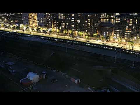
Dijksgracht lies on the eastern and northern side of the central rail node. The panning webcam alternates between tracks, trams, waterfront and contemporary buildings in the Eastern Docklands, producing a landscape very different from the classic canal ring.
This area is a reminder that Amsterdam is also a port and railway city. Oosterdok, docks and former service areas have been transformed over time, but the relationship with water and infrastructure remains visible. The stream is useful for observing rail traffic, sky conditions and waterfront change.
On the eastern side of the centre the city opens toward Oosterdok and the IJ. The scale changes here: narrow historic streets give way to larger contemporary buildings, terminals, converted harbour structures and broad surfaces of water.
The panorama from the Mövenpick area helps read this transition. Centraal Station can be related to the docklands and the open IJ, while light, cloud and haze strongly affect depth and visibility. It is one of the best live views for understanding weather over central Amsterdam.
The nine streams form a sequence. Dam and Damrak show the pedestrian core; Centraal Station and Stationseiland the principal gateway; Vijf Bruggen and PACS C11 infrastructure and works; Dijksgracht the eastern rail and waterfront zone; and the panoramic view the relationship between the city and the IJ.
Different times of day reveal different rhythms. Morning emphasises commuting and logistics, midday brings heavier visitor movement, while evening changes reflections and artificial light. Rain, wind and haze can completely alter the character of the same view.
The different live views make it possible to compare districts, light, visibility and city movement at the same moment. The guide grows with the archive, keeping each webcam connected to the place it actually shows.