
 ● LIVE
Town Square: real-time view of urban life and activity in Jackson.
Eighteen live webcams across Jackson and Jackson Hole: Town Square, Cache Street, Broadway Avenue, Snow King Mountain, the rodeo, Snake River, Hoback River and everyday life below the Tetons.
18 webcams onlineSelect a live view: the Play button opens the dedicated page for that specific camera.
● LIVE
Town Square: real-time view of urban life and activity in Jackson.
● LIVE
Town Square PTZ: real-time view of urban life and activity in Jackson.
 ● LIVE
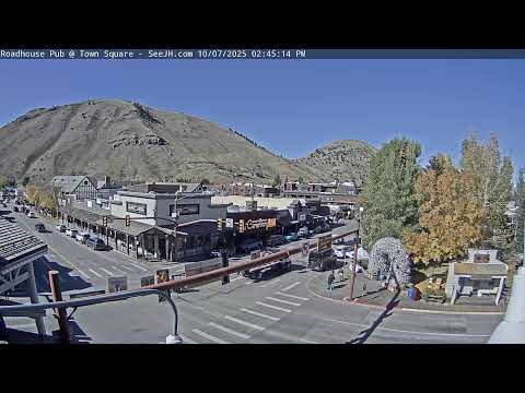
Cache Street: real-time view of urban life and activity in Jackson.
● LIVE
Town Square: real-time view of urban life and activity in Jackson.
 ● LIVE
Broadway Avenue: real-time view of urban life and activity in Jackson.
● LIVE
Dave Hansen Whitewater: live view of this location and its surroundings in Jackson.
 ● LIVE
Snow King Mountain, base: live view of snow, visibility and mountain scenery around Jackson.
 ● LIVE
Snake River Brewing: live view of this location and its surroundings in Jackson.
 ● LIVE
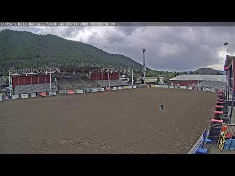
Jackson Hole Rodeo: live view of this location and its surroundings in Jackson.
 ● LIVE
Snake River Cabins: live view of this location and its surroundings in Jackson.
 ● LIVE
Flat Creek Inn: live view of this location and its surroundings in Jackson.
 ● LIVE
Snow King, mid-mountain: live view of snow, visibility and mountain scenery around Jackson.
 ● LIVE
Snow King Cowboy Coaster: live view of snow, visibility and mountain scenery around Jackson.
● LIVE
Snow King, summit gondola: live view of snow, visibility and mountain scenery around Jackson.
● LIVE
Snow King, lifts: live view of snow, visibility and mountain scenery around Jackson.
 ● LIVE
Gather Restaurant: live view of this location and its surroundings in Jackson.
 ● LIVE
Town Square: real-time view of urban life and activity in Jackson.
 ● LIVE
Hoback River: live view of the water, landscape and weather conditions from Jackson.
The map connects the streams with the main places shown by the webcams. Points represent viewed areas and geographic references, not necessarily the exact camera position.
Jackson is the principal town in Jackson Hole, the broad valley of north-western Wyoming. Jackson Hole is the geographic name of the valley, while Jackson is the incorporated town near its southern end. The landscape is framed by the Tetons to the west, the Gros Ventre mountains to the east, the National Elk Refuge and the rivers that connect the town with the wider Greater Yellowstone ecosystem.
The eighteen live streams gathered here show much more than a single mountain panorama. Town Square and downtown streets reveal the urban heart; Snow King rises directly above the town; the rodeo and local businesses reflect western culture; Snake River and Hoback River introduce the natural landscape that makes Jackson an important gateway to Grand Teton National Park.
History, landscape and landmarks that help interpret what appears in the live images.
Jackson Hole is the name of the large valley below the Teton Range, not simply a tourism brand. Jackson is the incorporated town in the southern part of the valley and the only incorporated municipality in Teton County. This distinction matters because many attractions marketed as “Jackson Hole” lie outside the town itself.
Jackson concentrates services, restaurants, galleries, lodging and connections toward Grand Teton National Park, Teton Village, the National Elk Refuge and the roads following the Snake and Hoback rivers. The webcams capture precisely this meeting point between a small western town and a much larger mountain landscape.
Archaeological evidence indicates human presence in and around the valley for roughly 11,000 years. Different Indigenous peoples travelled seasonally through the area, following wildlife, waterways and mountain routes as part of wider networks of hunting, gathering, exchange and movement.
Permanent Euro-American settlement came much later. Jackson received its name in 1894 and was incorporated in 1914. In 1920 the town became known for electing an all-female town council, an important episode in local civic history.
Jackson's central landmark is Town Square, formally George Washington Memorial Park. The park was dedicated in 1934 and occupies a block surrounded by shops, restaurants and galleries. Several of the Jackson webcams are concentrated around this square.
Each corner is marked by an arch made from elk antlers. The antlers come from the natural annual shedding of regional elk; the first arch was built in 1953 and the structures are periodically rebuilt. Town Square webcams combine these landmarks with traffic, pedestrians and seasonal events.
Immediately north and east of Jackson lies the National Elk Refuge, established in 1912 to protect winter habitat for elk. Today it protects more than 24,700 acres of grassland and wetland and also provides habitat for bison, bighorn sheep, trumpeter swans, eagles and other wildlife of the Greater Yellowstone ecosystem.
Large numbers of elk move into lower elevations during winter, while late spring begins the migration back toward higher summer ranges. This seasonal movement explains why wildlife and open space remain so visually present even close to downtown Jackson.
Snow King rises immediately south of downtown and is a constant presence in the townscape. Local skiing on the mountain dates back to the 1920s, and an organised uphill tow was created in 1939. Snow King is widely described as Wyoming's first ski area.
Today the webcams cover the base, mid-mountain, gondola, lifts and Cowboy Coaster. In winter they focus on snow and skiing; in warmer months they reveal hiking, mountain operations, summer attractions and the remarkably direct relationship between the mountain and downtown.
To generations of residents, Snow King has also been the town's own “Town Hill.” Before modern lifts, skiers climbed the slope on foot. In 1947 Wyoming's first single chairlift opened there, constructed in part from equipment acquired from an old mining tramway.
This history makes the Snow King cameras more than generic ski webcams. They show a mountain deeply connected with local identity, visible from central Jackson and now used for both winter sports and a growing range of summer activities.
Rodeo has been part of local culture for more than a century. Jackson Hole Rodeo traces its tradition to 1890 and continues to present seasonal competitions including bull riding, barrel racing, roping, bronc riding and other events associated with North American rodeo.
The rodeo webcam changes dramatically with the schedule. On quiet days the arena and stands dominate; on competition evenings the scene fills with horses, riders, spectators and lighting. It is one of the clearest live expressions of Jackson's western identity.
Snake River runs through Jackson Hole and Grand Teton National Park before continuing toward Idaho and the Columbia River basin. Within the park it follows multiple channels through sagebrush flats, forest and mountain scenery used by a wide range of wildlife.
South of Jackson the river also supports rafting and other recreation. Webcams linked with whitewater operators and riverside lodging can reveal river level, weather, vegetation and the strong seasonal change that shapes outdoor activity.
Hoback River flows through a narrower mountain landscape south-east of Jackson and joins the Snake near Hoback Junction. The river corridor is also an important natural and road route connecting Jackson with other parts of Wyoming.
The Hoback webcam therefore expands the city page beyond downtown. River flow, snow, vegetation, daylight and road conditions can change quickly and demonstrate how strongly the Jackson area responds to elevation and season.
Cache Street and Broadway Avenue are central axes of downtown Jackson. Around Town Square they carry local and visitor traffic past shops, restaurants, galleries, hotels and civic spaces.
Street webcams are particularly valuable because they show Jackson without the idealised postcard view: snow on the road, service vehicles, pedestrians, bicycles, peak traffic and sudden changes in activity during holidays or events.
Flat Creek crosses the Jackson area and continues toward the National Elk Refuge. Lodging on the northern side of town looks toward more open ground and marks a rapid transition between the built centre and the wider valley.
The Flat Creek Inn webcam is useful because of this setting. Sky conditions, snow accumulation, visibility and road activity become practical indicators of real conditions on the north side of Jackson.
The eighteen streams work best as one system. Town Square, Cache Street and Broadway show downtown; Snow King shows the mountain; the rodeo and restaurants show social and western culture; Snake River, Hoback River and Flat Creek connect the town with the natural landscape.
Season changes everything. Winter brings snow, ice and evening lights; spring brings runoff and thaw; summer brings rafting, rodeo and heavier visitor movement; autumn quietens the town and makes the transition toward cold weather increasingly visible.
The different live views make it possible to compare districts, light, visibility and city movement at the same moment. The guide grows with the archive, keeping each webcam connected to the place it actually shows.