
 ● LIVE
Sterling Reef: live view of this location and its surroundings in Panama City Beach.
Panama City Beach stretches along the open Gulf coast of Florida’s Panhandle, where pale sand and a broad horizon provide the setting for both large beachfront resorts and quieter coastal communities. Its visitor landscape is linear: moving east or west can change the atmosphere more than moving a few streets inland.
5 webcams onlineSelect a live view: the Play button opens the dedicated page for that specific camera.
● LIVE
Sterling Reef: live view of this location and its surroundings in Panama City Beach.
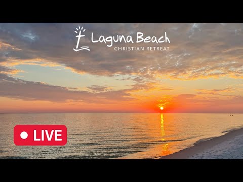 ● LIVE
Laguna Beach: live view of the shoreline, sea conditions and coastal atmosphere in Panama City Beach.
 ● LIVE
Majestic Towers: live view of this location and its surroundings in Panama City Beach.
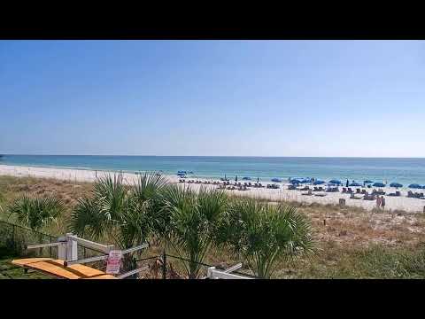 ● LIVE
Moonspinner: live view of this location and its surroundings in Panama City Beach.
● LIVE
Panama City Beach: live view of the shoreline, sea conditions and coastal atmosphere in Panama City Beach.
The map connects the county pier with St. Andrews in the east and Camp Helen in the west. Markers identify visitor landmarks, not camera mounting points.
Panama City Beach stretches along the open Gulf coast of Florida’s Panhandle, where pale sand and a broad horizon provide the setting for both large beachfront resorts and quieter coastal communities. Its visitor landscape is linear: moving east or west can change the atmosphere more than moving a few streets inland.
The destination is distinct from Panama City, across the bay to the east, and from the capital of Panama. A rewarding visit combines the developed beach strip with St. Andrews State Park, the western communities around Laguna Beach and the historic landscape of Camp Helen. Piers, wetlands and a diving museum add depth to the familiar seaside holiday.
History, landscape and landmarks that help interpret what appears in the live images.
The open Gulf frontage lies on the seaward side of a landscape of lagoons, bays and coastal lowlands. Grand Lagoon and St. Andrew Bay belong to a different water environment from the surf beach. Panama City has its own downtown and bayfront districts across the water; its sights should not be confused with the beachfront resort area. Front Beach Road follows much of the holiday strip, while Panama City Beach Parkway provides an inland road corridor. Distances along this coast merit planning rather than assuming everything is walkable.
The bay-side and Gulf-side distinction matters when choosing an outing. A marina trip on Grand Lagoon is not simply the same beach seen from a different car park, and a visit to Panama City’s downtown belongs to another urban setting. Bridges and connecting roads organise those movements. Use the actual place name and address when planning, especially for accommodation described commercially as Panama City Beach but located in the wider coastal area. A regional destination label is often broader than municipal boundaries.
The modern resort story is associated with Gideon Thomas and the opening of his Panama City Beach development in 1936. Tourism, roadside accommodation and seaside recreation helped shape the area’s identity. The present municipality took form on 12 August 1970 through the merger of Edgewater, Panama City Beach, Long Beach and West Panama City Beach. This layered origin explains why the city feels like a sequence of beach districts rather than a single old town. Contemporary condominium towers coexist with the memory of smaller-scale family holidays.
The merger also provides a way to read the surviving place names. Long Beach, for example, is part of the resort’s own historical geography, rather than a reference to the better-known Californian city. Large buildings and major attractions now dominate many impressions, but the memory of small motels, road trips and recurring family holidays remains important to the destination’s culture. Its most characteristic landmarks often concern leisure and travel rather than ancient monuments. Looking for that history gives ordinary beachfront names more meaning.
The beach’s pale sand is rich in quartz, linked to sediment carried from the Appalachian region into the Gulf and redistributed along the coast. Its bright appearance is geological, not evidence of a coral reef at each resort. Water colour changes with light, wind, suspended material and viewing angle; an emerald photograph is not a promise of identical conditions every day. Dunes and beach vegetation help stabilise the shore. Use designated access routes and leave those living edges intact when walking between the road and the sand.
Beach width and profile can vary after storms and through coastal restoration. Published local information describes renourishment projects on selected stretches, showing how beach management and natural processes interact. A wider or narrower strand in a picture does not, on its own, identify a particular project or establish current erosion conditions. It is more useful to understand the coast as a system: waves redistribute sand, dunes help retain it and access routes concentrate foot traffic. That perspective makes a walk along the shore more informative than treating the beach as uniform ground.
Russell-Fields City Pier stands opposite Pier Park, providing a seaward walk close to shops and restaurants. M.B. Miller County Pier is farther east near the Sterling Reef and Shipwreck Island area. Both extend well beyond the beach, allowing visitors to see the shoreline from offshore without taking a boat. They are separate landmarks, not two names for one pier. Anglers and walkers share these structures; check current admission, fishing arrangements and any weather closure before setting out.
The distinction between the piers is particularly useful for families meeting separately or visitors arranging fishing. The county facility lists mobility mats, restrooms and several beach accesses, while the Russell-Fields area relates to the shopping and dining environment of Pier Park. Facilities and payment arrangements can change, and a pier’s opening hours do not necessarily describe lifeguard duty hours. Confirm the particular service needed rather than transferring information from one pier to the other. They can be enjoyed as different outings along the coast.
At the eastern end, St. Andrews State Park brings together Gulf beach, dunes, woodland and shores facing the bay. Established in 1947, it offers a broader coastal encounter than a resort beach alone. The jetties at the pass help explain the meeting of open water, navigation and protected coastal habitats. Birdwatching and nature trails reward a slower visit. Choose activities according to conditions and official advice: a sheltered-looking corner is not a guarantee of safe swimming, and park access can be temporarily restricted.
The park is also a place for investigating habitats away from the main swimming areas. Official information identifies the Gator Lake and Heron Pond trails; an inland walk can shift attention from waves to water birds, woodland and freshwater environments. Gator Lake is man-made, associated with the channel works of the 1930s, but now supports wildlife. Observe from appropriate paths and overlooks and never feed animals. A park visit becomes richer when its varied environments are treated as connected parts of a landscape rather than a single beach attraction.
Shell Island lies across the pass from the park’s mainland section. The present separation reflects construction of the Gulf–bay channel in the 1930s, so this apparently timeless landscape also has an engineered history. A boat excursion offers undeveloped shoreline rather than a town with shops and cafés. Confirm current transport, return arrangements and available services, and bring the supplies needed for the outing. Respect nesting wildlife and take rubbish back. Dolphins may inhabit local waters, but no excursion can guarantee a sighting.
The mainland park and the island should be planned as separate stages. A boat ticket, a park entry and a place to park may involve different arrangements; they are not automatically bundled into one experience. Ask what services are available at the island landing and what happens if weather changes the return trip. Nature observation benefits from realistic expectations: nesting birds, dune vegetation and the absence of development can be as significant as a conspicuous dolphin sighting. The quieter details often reveal more about the coast’s ecology.
Near the western end of the destination, Camp Helen State Park combines the Gulf shore with Lake Powell, a coastal dune lake. The Lodge and Rainbow Cottages preserve an earlier holiday landscape. Avondale Mills used the property as a retreat for its Alabama textile workers from 1945 to 1987; it opened as a state park in 1997. The buildings connect leisure history with working lives far inland. Walking through the historic area and towards the beach offers a different rhythm from the high-rise resort strip.
Camp Helen’s preserved buildings distinguish it from parks visited only for scenery. The Lodge and Rainbow Cottages invite questions about who could afford holidays, how people travelled and why an inland textile company provided access to the coast. The documented history of the property reaches beyond its state-park opening. Lake Powell adds another dimension: its position beside dunes and Gulf shoreline makes it part of a rare coastal-lake landscape. A visitor can combine architectural and social history with a walk through several natural settings, rather than choosing between a museum day and a nature day.
Laguna Beach belongs to the broader western beach destination, with a more residential atmosphere than the central tower-lined districts. This is Florida’s Laguna Beach, not the Californian city of the same name. The western coast makes a useful base for exploring Camp Helen and Lake Powell, while remaining connected to the wider resort area by road. Quietness varies with the season and access point. Use signed public beach access and avoid assuming that every path between coastal homes is a public route.
Local community history places particular importance on the open shoreline and the effort to prevent parts of the seaward strip from being built over. That history helps explain the residential character people value, but it should not be treated as a current statement of access rights over every parcel. Historic plans, property arrangements and public routes are different matters. For the visitor, the practical approach is simple: use current signed access, respect homes and driveways, and look for the way community life has shaped the landscape as well as the way tourism has changed it.
Panama City Beach Conservation Park shifts attention inland to wetlands, pine landscapes and boardwalks rather than surf. Its trail network forms part of a wider recreation system connected through Gayle’s Trails; Frank Brown Park provides another major recreational hub. Wetland restoration is part of the park’s purpose, making the landscape more than leftover open land. Choose a trail length suited to the weather, take drinking water and allow for limited shade on some stretches. Check trail conditions after heavy rain rather than relying on a beach forecast alone.
Wetland restoration and public recreation coexist here. Boardwalks allow access across areas that would otherwise be difficult to explore, while different trail lengths let walkers choose a suitable outing. The inland landscape also explains what beach development can hide from view: the coast includes water-storage areas, woodland and low ground, not just a narrow ribbon of sand. Conditions may differ from those at an exposed beachfront. Check the selected trail and allow time to return, particularly in heat or after periods of heavy rain.
Man in the Sea Museum tells the story of underwater exploration, including military and commercial diving and the SEALAB programme. It adds a scientific and maritime dimension to a destination often represented only by sunbathing. Family attractions such as Shipwreck Island provide a different kind of recreation from the state parks. Around Pier Park, shopping and dining sit near the beachfront, while Aaron Bessant Park hosts public performances and events. Consult the current programme: the presence of an amphitheatre does not mean a concert takes place every evening.
The diving museum is especially relevant to a visitor watching an apparently featureless sea horizon. Its equipment and SEALAB-related interpretation show how people learned to work and live below a surface normally seen only from above. This is a different maritime story from recreational boat trips or beach fishing. Combining it with an outdoor coastal visit gives the water another meaning. For events at Aaron Bessant Park, use a dated programme and consider travel and parking separately from a beach stop, since attendance can change the rhythm of the surrounding district.
Seafood restaurants, casual beach dining and family-run holiday traditions help define local life. Pineapple Willy’s, welcoming visitors since 1984, is one recognisable name on the central shore. Its setting illustrates how food, beach views and social occasions overlap. Majestic Towers and Sterling Reef represent the condominium-resort side of the coast; Moonspinner lies at the Thomas Drive end beside St. Andrews State Park. These names locate different visitor settings, not a single central square. Compare menus and practical access without treating every seafront business as interchangeable.
Food and accommodation also show how different generations use the destination. Some visitors return to a familiar restaurant each holiday; others organise the stay around an apartment and occasional meals out. Neither pattern represents the whole city. A named beachfront business can act as a meeting point and a memory of family trips, while a quieter western neighbourhood supports another pace of life. It is worth exploring those differences without assigning an invented historic status to every building or assuming that an old business name guarantees an unchanged menu or service.
Allow separate outings for the eastern park, the central beach and the western lake landscape. Northwest Florida Beaches International Airport serves the area; check onward transport and the exact accommodation address. Summer brings heat, humidity and thunderstorms, while cooler seasons suit many walks but do not guarantee warm swimming water. Follow beach flags and official restrictions, including any water-entry closure. The map marks M.B. Miller County Pier, St. Andrews State Park and Camp Helen as visitor landmarks, not camera mounts. Check opening and access information before travelling to them.
A balanced itinerary might give the county-pier coast and central beach one outing, St. Andrews and any separately arranged island visit another, and the western lake and historic park a third. Add an indoor museum or a shorter nature walk according to interests and weather. The purpose is to avoid compressing a long coastline into one rushed excursion. Maps provide orientation, but opening times, return transport and access needs complete the practical picture. Allowing space for those details makes the trip more reliable without turning it into a rigid timetable.
The different live views make it possible to compare districts, light, visibility and city movement at the same moment. The guide grows with the archive, keeping each webcam connected to the place it actually shows.