
 ● LIVE
Surf Station: live view of the shoreline, sea conditions and coastal atmosphere in St. Augustine.
Explore the relationship between the old town, Matanzas waterfront, Vilano and Anastasia Island through seven different catalogue subjects.
7 webcams onlineSelect a live view: the Play button opens the dedicated page for that specific camera.
● LIVE
Surf Station: live view of the shoreline, sea conditions and coastal atmosphere in St. Augustine.
 ● LIVE
Vilano Pier: real-time view of the water, boats and maritime activity in St. Augustine.
 ● LIVE
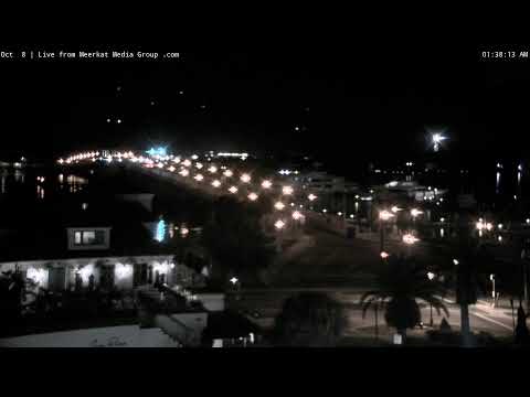
Bridge of Lions: live view of transport links, infrastructure and movement around St. Augustine.
 ● LIVE
Castillo de San Marcos: live view of this location and its surroundings in St. Augustine.
 ● LIVE
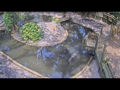
Alligator Farm: live wildlife view from the St. Augustine Alligator Farm zoological park.
 ● LIVE
Matanzas River and Bridge of Lions: live view of transport links, infrastructure and movement around St. Augustine.
 ● LIVE
St. Augustine Florida Skyline: live panorama showing light, sky conditions and visibility across St. Augustine.
Tourist reference points connect the fortress with Anastasia’s protected coast and Fort Mose. These markers do not locate webcams.
St. Augustine stands on Florida’s Atlantic coast, but its historic centre faces sheltered tidal waters rather than an ocean beach. Matanzas Bay and the Matanzas River separate the old town from Anastasia Island; Vilano lies north of the inlet. This geography explains why a surfing subject, a bridge and a fortress tell different stories about the same destination.
Founded by Pedro Menéndez de Avilés in 1565, the Spanish settlement grew in an Indigenous landscape. Its history includes colonial conflict, African communities, slavery and struggles for freedom, followed by railway tourism and the civil rights movement. The seven webcam labels provide starting points for exploring these layers, without establishing a verified field of view for each camera.
History, landscape and landmarks that help interpret what appears in the live images.
The Matanzas waterfront belongs to a tidal estuary connected to the Atlantic through the inlet. Waves on the exposed beaches and ripples beside the old town therefore reflect different environments. Anastasia Island carries the lighthouse, wildlife attractions and ocean beaches; crossing the Bridge of Lions changes both the landscape and the scale of a visit. Vilano’s public pier faces inland waters, while its Atlantic beach is a separate shoreline.
The island and estuary are best understood as a connected coastal system. Ocean sand, dunes, maritime woodland, tidal creeks and sheltered water occur close together, yet support different activities and habitats. A person standing beside a calm waterfront may be only a short drive from a beach affected by wind and breaking waves. This is why the city’s live subjects should be compared by setting rather than simply ranked as better or worse views. They describe different edges of the same coast, and none can stand in for the condition of every other shoreline.
The Castillo de San Marcos was built between 1672 and 1695 to defend the harbour. Its coquina walls link military engineering to local geology: compressed shell fragments produced a workable coastal stone. Around the central Plaza de la Constitución, the street pattern preserves the logic of a Spanish colonial town. St. George Street and Aviles Street reward walking, but surviving buildings, later alterations and reconstructions should not all be assigned the same age.
The town plan is as important as an individual façade. The plaza acted as a focus for religious, civic and commercial functions, while streets connected it with the harbour and residential blocks. Exploring those relationships gives the old town an intelligible structure. Walk slowly between the plaza, the bayfront and Aviles Street, noticing the transition from public square to narrower lanes. The Castillo belongs to this urban story but also has a much wider strategic scale: its position guarded the harbour of a Spanish outpost connected to transatlantic routes and rival European claims.
The siege of 1702 explains an important distinction between the age of the settlement and the age of its streetscape. English forces failed to capture the Castillo, where townspeople had taken refuge, but burned the town before withdrawing. Later reconstruction and additional defences reshaped the urban landscape. St. Augustine’s 1565 founding therefore does not mean that a present-day walk is surrounded by intact buildings from that first year. The fort’s survival contrasts with the vulnerability of houses and other structures outside its walls.
The name Matanzas also preserves a difficult historical memory. It refers to the killing of French forces by the Spanish in 1565 near the inlet farther south. Fort Matanzas itself was built much later, in the eighteenth century, to protect the southern approach. These events should remain distinct: the founding-era conflict, the seventeenth-century Castillo and the later southern fort are separate parts of a long colonial contest. Reading them together helps explain why a seemingly peaceful coast contains several military landmarks and why their interpretation involves people, religion and imperial rivalry as well as engineering.
Fort Mose, north of the historic centre, tells the story of a free Black community established under Spanish rule in 1738. Its history belongs alongside the enslaved and free Africans present in St. Augustine from its founding. Lincolnville, developed after the Civil War, adds another essential chapter: local residents and national campaigners challenged segregation in the 1960s. Visit its museum and interpreted sites to understand people and institutions beyond the picturesque waterfront.
These histories also call for precise language. A free Black settlement under Spanish rule did not mean the absence of slavery in Spanish Florida. Likewise, the picturesque setting of a former colonial capital does not remove the violence of conquest or the experiences of Indigenous peoples. Fort Mose and Lincolnville help expand a visit beyond rulers and wealthy travellers. Their stories connect particular households, churches and community organisations to changes in law and freedom. They deserve time as destinations, rather than a brief footnote added to an otherwise architectural walk.
The former Hotel Ponce de Leon, opened in 1888 and now part of Flagler College, marks a later transformation. Henry Flagler’s hotels and transport interests helped make the city a winter destination. The Lightner Museum occupies the former Hotel Alcazar, also completed in 1888. Their elaborate architecture is a distinct historical layer, rather than a survival from the original Spanish settlement. Tours and museum visits offer more context than recognising a distant roofline.
The two former hotels are not interchangeable institutions today. The Ponce is a working college building, while the Alcazar houses a museum with its own collection and visiting arrangements. A tour of the college explores a former luxury resort through spaces now used for education; a museum visit follows a different sequence. Confirm public access and available tours separately. Looking beyond ornate surfaces also raises useful questions about the infrastructure behind leisure: transport, construction, staff and services made the winter resort possible. Its grandeur reflects a particular economic moment, not the appearance of all local life.
The current St. Augustine Lighthouse was first lit in 1874. Its museum connects navigation, shipwreck archaeology and coastal work. Nearby, the Alligator Farm is a zoological attraction, while Anastasia State Park protects a wider landscape of beaches, tidal marsh and trails. These are separate visits with different purposes. A zoo enclosure does not represent the whole wetland ecosystem, and a beach outing does not substitute for the island’s maritime history.
Anastasia State Park offers a particularly useful connection between nature and the built city. Its historic coquina quarries supplied stone for construction in St. Augustine. Elsewhere in the park, the Ancient Dunes Nature Trail and the Salt Run area introduce maritime woodland and tidal habitats. These places shift attention from monuments to the landscapes that supported them. A lighthouse climb, a quarry visit and a beach walk answer different questions: how people navigated, where building material came from and how the barrier coast continues to change. Choose a combination that allows time to understand each.
Vilano offers a community-scale alternative to the old town, with an inland-facing pier and access to the ocean coast. South of the inlet, Anastasia Boulevard links island businesses and attractions. Surf Station began in a former gas station in 1984 and became part of the local surfing community. Understanding that history adds a human dimension to the coast: beaches are working places for instructors, retailers and residents as well as holiday settings.
A1A links these coastal communities but does not erase their differences. Vilano sits north of the inlet; Anastasia Island lies south of it; St. Augustine Beach is a distinct municipality farther along the island coast. A booking address or attraction name is therefore more useful than a broad regional label when arranging transport. Food offers another route into local identity: seafood traditions and Minorcan influences form part of the wider city’s culture. Treat menus and opening hours as current practical information, while using the historical context to understand why coastal work, migration and hospitality meet here.
The striped lighthouse is more than an island landmark. Its present tower, first lit in 1874, belongs to a sequence of aids to navigation along a changing coastline. The museum interprets the lives of keepers and the work needed to make a light dependable, alongside the wider history of maritime activity. A tower that appears picturesque from outside also represents maintenance, technology and the daily discipline of coastal service. Its museum collections and research help replace the idea of an empty seascape with a history of boats, cargoes, workers and wrecks.
The Lighthouse Archaeological Maritime Program investigates submerged cultural heritage, while conservation turns recovered objects into evidence that can be studied. A visit can therefore connect a broad horizon with very small details: fastenings, ceramics or other material traces of earlier voyages. Climbing and museum access have their own requirements, and visitors should check what is suitable for their group. The lighthouse is a destination on Anastasia Island; its historical importance does not establish that it is visible from any particular webcam in this collection.
Begin with the old town rather than driving between every attraction. The Castillo and the central waterfront establish the harbour setting; the plaza and nearby streets explain the town plan; the Flagler buildings introduce a later architectural chapter. Add Lincolnville as a purposeful extension with its own museum and community history. This route mixes outdoor space with interpreted interiors and leaves room to notice ordinary building uses. A residential street, a college courtyard and a museum entrance have different public-access expectations, even when all fall within the tourist district.
Give a separate outing to Anastasia Island, choosing between the lighthouse, zoological park and protected coast according to interests. A third outing can focus on Vilano and Fort Mose, recognising that the beach community and the historic park are separate stops. This arrangement is a geographical framework, not a fixed schedule or a promise that every site will open on the same day. Check actual addresses, access needs and the distance between stops. Leaving time for transport and a meal is more rewarding than treating seven catalogue labels as seven compulsory photo stops.
Combine the Castillo, the plaza and the central waterfront on foot; give Lincolnville time of its own. Plan Anastasia Island and Vilano as additional outings rather than assuming all seven catalogue subjects are adjacent. Summer heat and thunderstorms can interrupt outdoor plans. Check official access, beach flags and attraction information before travelling. The map marks visitor destinations, not camera installations; nearby landmarks are not automatically visible in a stream.
The live subjects can help establish atmosphere before a visit: the contrast between an urban waterfront, an open coast and an animal setting is useful in its own right. For practical decisions, however, use the responsible organisations. Museum opening times, park access, bridge operations and beach restrictions belong to different services. The tourist map uses landmark locations as an orientation aid. It places the harbour, island attractions and northern sites in relation to one another; the markers do not represent additional cameras or promise a particular view.
The different live views make it possible to compare districts, light, visibility and city movement at the same moment. The guide grows with the archive, keeping each webcam connected to the place it actually shows.