Matanzas River: the tidal waterway around the Bridge of Lions
This catalogue entry names both the Matanzas River and the Bridge of Lions. Its emphasis is the waterway that gives the crossing its purpose: tidal water connects the historic harbour, island shores and routes through the inlet. It complements the bridge article by looking first at geography and navigation.
A river shaped by the sea
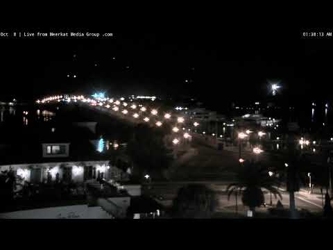
Despite its river name, this is a tidal coastal setting rather than a mountain-fed stream. The connection to the Atlantic helps explain changes in water level and current. Reflections, ripples and boat wakes can reveal surface movement, but do not measure depth, water quality or a safe course.
The waterfront as a working edge
St. Augustine’s old town developed beside a harbour, not merely a scenic pool. Seawalls, crossings and moorings express different needs along the same edge. Watching the water for several minutes can make their relationship more understandable than a still photograph, without identifying every distant boat or its destination.
Matanzas places that should stay distinct
Fort Matanzas National Monument lies farther south and is a separate excursion; it is not another name for the Castillo beside downtown. The Bridge of Lions provides a central crossing to Anastasia Island. Using these names precisely keeps the broader waterway from collapsing into a single landmark.
An estuary behind a misleadingly simple name
The National Park Service explicitly describes the Matanzas as an estuary rather than a conventional river. This distinction matters because tidal exchange, coastal inlets, marshes and shallow margins shape its character. It should not be imagined as a uniform channel carrying freshwater steadily in one direction from a distant upland source. Water level and movement vary through tidal cycles, while weather can alter the appearance and conditions at the surface. The urban waterfront is one segment of a much larger coastal system.
The broader Guana Tolomato Matanzas research landscape includes linked estuarine environments with different habitats. Scientific monitoring examines these systems over time; one webcam image cannot perform that role. A muddy colour, exposed margin or unusually smooth patch needs context before it is interpreted as a sign of pollution, drought or a particular tidal stage.
Marshes and shallow edges are part of the waterway
Open water is only the most immediately legible part of the estuary. Tidal creeks, marshes, sand and mud flats support ecological processes that are easier to understand at designated nature sites. Changes in water level alternately cover and reveal parts of those edges. Birds may use shallow water to feed, while vegetation helps define the boundary between channel and land. These habitats are connected to the water beside the city even when they are outside an urban camera’s view.
A visit to a reserve or interpreted shore can turn a broad water panorama into a more detailed ecological picture. Use established access and avoid disturbing feeding or nesting wildlife. The point is not to assign a species to every distant mark on the image, but to understand why a tidal waterfront belongs to a living landscape rather than an ornamental backdrop.
Follow the city’s built edge, then change scale
Avenida Menendez and the bayfront provide a street-level introduction to the city’s relationship with tidal water. The seawall is evidence of repeated efforts to organise and protect that edge; bridges and moorings show other uses. Walks here can be paired with the Castillo, whose military position depended on harbour geography, or the plaza, which connects water access with the town’s civic centre. The same waterway can therefore be read through engineering, defence, daily transport and public space.
Farther south, Fort Matanzas interprets another defensive location near a different inlet. It should be planned with its own official access information rather than assumed to be a quick extension of a downtown walk. Comparing the two monuments helps explain why coastal defence worked at several points instead of concentrating in one castle. This webcam subject contributes a broader geographical framework for those separate visits.
The name carries a history beyond the water
Matanzas is a Spanish name connected with the killing of French forces in 1565 near the southern inlet. The event predates the stone fort there by almost two centuries. This is why the waterway’s historical meaning should not be reduced to a pleasant boat route or confused with the construction date of Fort Matanzas. The place name links a present coastal landscape to the violent competition for colonial territory. Reliable interpretation at the national monuments sets out the separate episodes; the article uses that context without suggesting that the southern inlet or its fort appears in this downtown river subject.